Read Next

It takes a lot to wow my teenage son
Glaciers, grizzly bears and ghosts of the Gold Rush – Jane Knight and her teenage son take an action-packed voyage along Alaska’s west coast

Buss Family
Rainer Buss counts sons Frederick and Thomas among his colleagues. To celebrate Father’s Day, we asked them what it’s like to work alongside their father – and each other
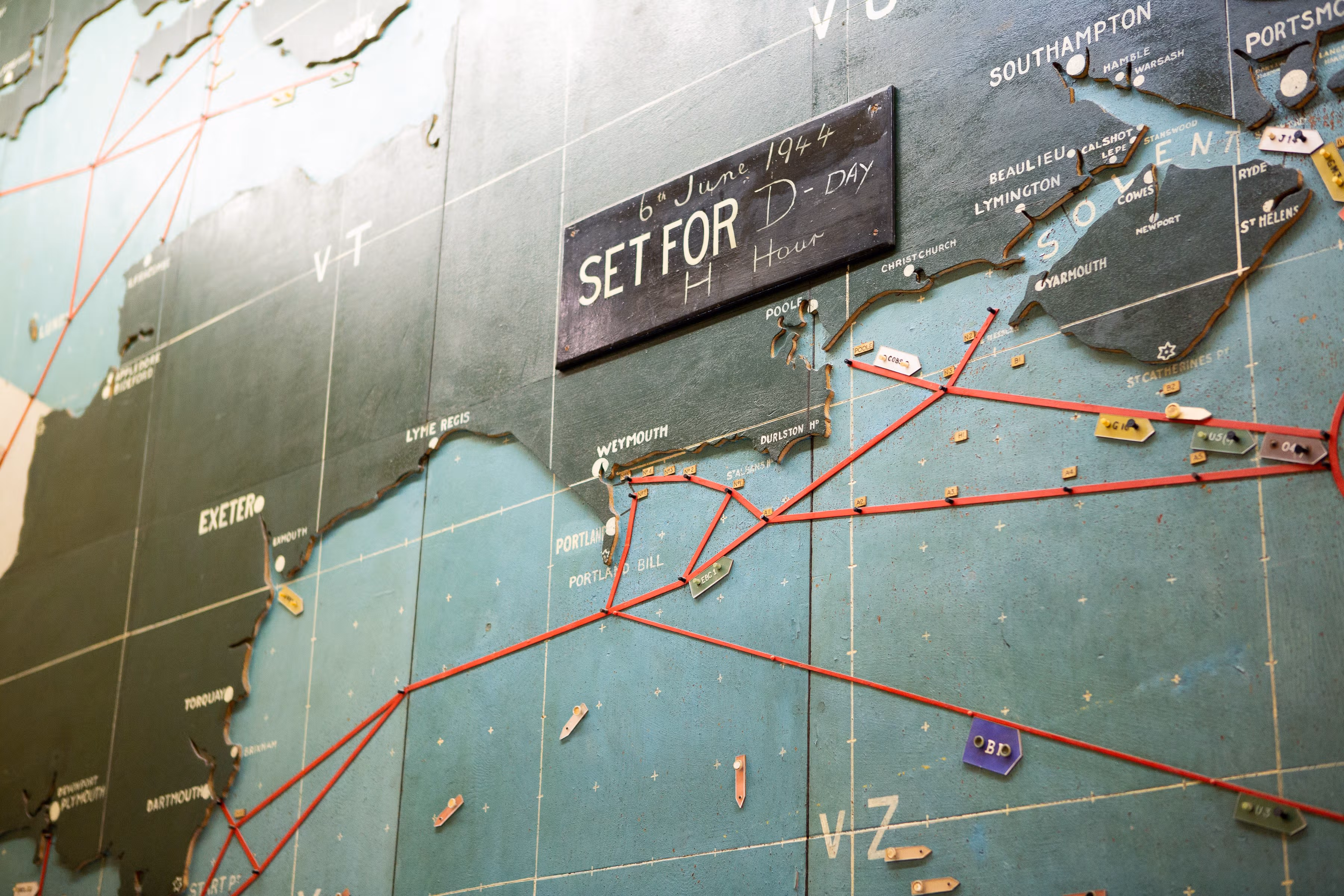
On a ridge above the English port in 1944, two generals were plotting a turning point in World War II...
The sleepy village of Southwick, five miles from the Portsmouth docks, may seem like a quiet backwater in a fold of the South Downs, yet this is the unlikely former nerve center of the Allied invasion of Europe in 1944.
It was from Southwick House, a Georgian mansion on a country lane, that General Eisenhower and his British counterpart, General Montgomery, directed the assault of Allied troops on the Normandy coast – D-Day, codename Operation Overlord – a strategy they plotted using a wooden map that hangs there to this day. A turning point in World War II, it set the Allies on the path to victory in 1945, 80 years ago.
Created by the British toy manufacturer Chad Valley, the map originally covered a swathe of territory from the north of Norway to the Pyrenees on the northern border of Spain, taking in both Britain and Ireland. Yet, only a section of territory was of real interest to the military strategists, who had commissioned the larger map to guard against loose lips and ensure enemy agents were thrown off the scent.
In fact, so secret were these plans that to prevent any possibility of sabotage, the Royal Navy carpenter tasked with putting up the map and burning the irrelevant sections was commanded to remain on site for several months. He wasn’t alone; an engineer who came to fix a telecommunications problem caused by a storm, which famously delayed the operation by 24 hours, was also required to stay put.
The toymaker’s map is on show within The Royal Military Police Museum at the Defence School of Policing and Security, which has been based in the mansion since 1946. Yet it’s not the only legacy of this Sussex village’s improbable role in history. There’s also a plaque on the local pub, the Golden Lion, which, for a while, was Eisenhower and Montgomery’s favorite place for a pint. See it for yourself the next time your cruise takes you to Portsmouth.
Booking is essential to visit the D-Day Map Room, contact The Royal Military Police Museum. Photo courtesy of Visit Hampshire